Collaborations
Ongoing collaborations
One of the main purposes of Global Wader is to facilitate collaborations among those interested in pursuing common aims, be it from local studies with very specific conservation applications, to global analyses of migratory behaviour of a given species to expand the current knowledge.
If you think Global Wader could help you reach out to others in order to start a relevant collaboration, please drop us an email at globalwader@waderstudygroup.org.
Ongoing collaborations led by Global Wader team or others:
The Global Relevance of Protected Areas
How can a static network of protected areas effectively protect highly mobile species?
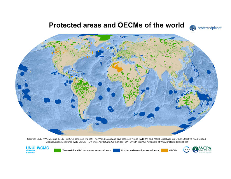
Due to habitat loss, degradation and fragmentation, finding suitable habitat is becoming increasingly difficult, even for highly mobile species like shorebirds. Protected areas are one of the most important tools to preserve biodiversity, but achieving this goal for species that occupy different regions of the globe seasonally, can be particularly challenging. The designation, management, and in some cases restoration of protected areas is therefore considered essential for the effective protection of migratory species in patchy and complex landscapes, often requiring coordination across vast geographical scales. But how often do shorebirds actually use protected areas? And how does this vary across time, particularly considering critical stages of the annual cycle, such as migration.
This new Global Wader collaborative initiative aims to quantify the relevance of protected areas for shorebird, at the global scale, by investigating how much individuals rely on those. Specifically, we aim to answer the following questions:
1. How frequently are shorebirds located inside protected areas? We will assess this by quantifying the proportion of location fixes located inside versus outside protected areas (using the WDPA database).
2. Are protected areas used more frequently during specific periods of the annual cycle? The annual cycle will be divided into different periods to explore use intensity within those and thus assess seasonal variation on protection coverage across the annual cycle.
3. Do species of higher conservation concern rely more frequently on protected areas than those with lower conservation status? We will investigate if use of protected areas varies across species with regards to their conservation status.
Wish to participate?
Awesome! If you have already registered GPS or PTT tracking data with Global Wader, please pay attention to your email as we will reach out. However, if you are yet to register tracking data with Global Wader and it includes at least one annual cycle at the individual level, please do fill in the Global Wader data agreement form and share your (meta-)data – we will take it from there.
Natal dispersal
Global Wader has entered a new partnership with Vogelwarte - Swiss Ornithological Institute and the Biodiversity Research Institute (CSIC/UO/PA), under the project "Drivers of avian natal dispersal patterns across species" . This research project aims to develop a global, cross-species meta-analysis on natal dispersal, with the following main objectives:
1. Identify informative standardized movement parameters comparable within and between species to describe patterns and variation in prospecting behaviour;
2. Quantify how species-specific morphological, ecological and life-history traits influence these metrics and their variation at the population, and cross-species level;
3. Determine how intrinsic information in naïve juveniles is supplemented by successive environmental sampling during prospecting and natal dispersal.
In order to reach those objectives, the first step is to assemble a global repository of juvenile dispersal tracks (GPS, VHF, PTT) to understand the drivers and constraints of movement during the transience (prospecting) phase – the time between leaving the nest and recruiting into the breeding population. Global Wader has agreed to support and facilitate the compilation of relevant juvenile wader/shorebird tracking data that can contribute into this exciting project.
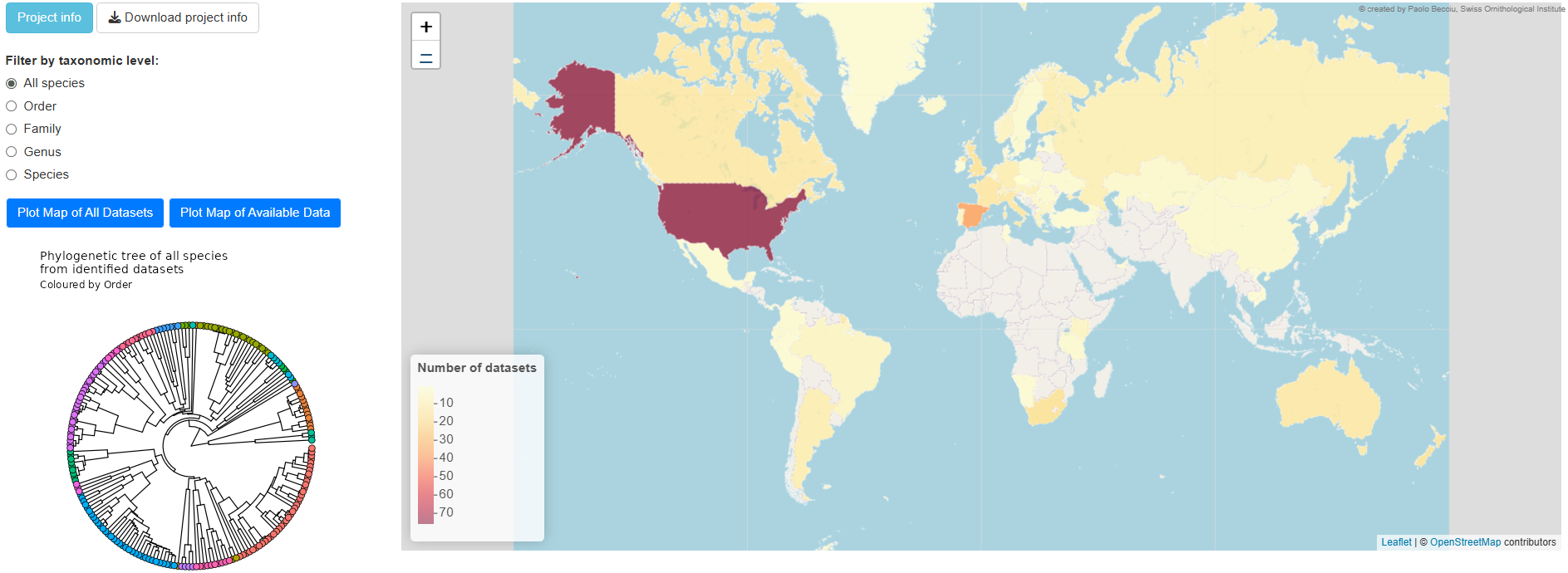
This activity is currently underway, with the compilation of juvenile tracking data across bird groups and the dataset is continuously increasing, with the most updated version available in the project's shiny app.
The project team is currently planning two complimentary publications. One focusing on Drivers of transience-phase movement - how morphological, ecological, and life-history traits shape patterns of dispersal movements. And another on exploring Information acquisition mechanisms - how juveniles acquire and use environmental cues during prospecting. Data contributors that provide relevant data will be invited as co-authors, receive regular updates and preliminary results, and have ample opportunity to provide feedback before manuscript preparation and submission.
Interested in contributing?
Great! If you have juvenile tracking data already shared with Global Wader, please pay attention to your email as we will reach out. However, if your juvenile tracking data is not yet registered with Global Wader, please do fill in the Global Wader data agreement form and share your (meta-)data – we will take it from there. You can also contact Global Wader highlighting your willingness to contribute in case no email has reached you.
Salty Migration:
a global quest for associations between breeding latitude & non-breeding habitat use
Do waders that breed at higher latitudes occupy more saline habitats during the non-breeding season?
Ecological specialisation often entails a trade-off between efficient resource use and flexibility in habitat choice. For migratory waders these trade-offs may manifest differently across species, potentially leading to variation in habitat associations and resource specialization. It has been described that waders breeding at higher latitudes also show a stronger association with coastal saline habitats during the non-breeding season. But is this case at both the species and individual levels? Harnessing the collaborative power of the Global Wader community and its unique multi-species, multi-site tracking dataset, we aim to:
• Investigate the individual level association between breeding latitude and the level of salinity of wintering locations;
• Assess the proportion of variation in this relationship that is explained by individual-, species- and Family-level differences.
In order to achieve those aims, we will:
1. Identify breeding sites considering known species-specific breeding range, and overlaying individual GPS fixes latitudinal positions. Different metrics will be explored, such as GPS fixes median latitude while also exploring movement recursions;
2. Quantify wintering habitat use by calculating the proportion of GPS fixes within saline habitats (mean “Salinity”) and GPS fixes mean distance to the coastline.
Preliminary results
Using the datasets provided by the Global Wader community and open-access data, we now have a much clearer understanding of the patterns between breeding latitude and wintering habitat used. This analysis includes 614 individuals from 15 species across 55 studies. Please keep in mind the exploratory nature of the plots presented below.
While we detected a positive relationship between mean breeding latitude and the use of saline habitats during the wintering season, this effect was not apparent when considering the simple distance to the coastline. Additionally, further exploration of the data revealed significant individual variation in saline habitat use.
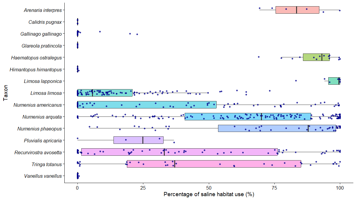
Intraspecific variation in the percentage of saline habitat use during the winter season among the analysed species. The plot displays the percentage of saline habitat use for individual tracked birds (blue points) overlaid with boxplots showing the median (bold vertical line), interquartile range (grey box), and full range (whiskers) for each species.
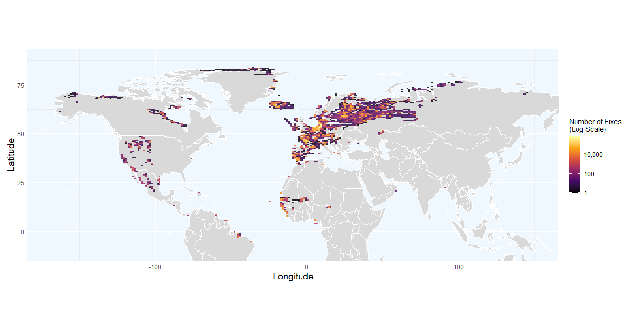
Density heatmap of wader fixes during the breeding and wintering seasons. Grid cell color indicates the total number of fixes.
HABITRACK
Global Wader has partnered with “HABITRACK – Habitat tracking for the conservation of huntable bird species”, a project funded by the European Union and coordinated by the French national museum of natural history (Museum National d'Histoire Naturelle) in collaboration with another six partner organisations, aimed at providing crucial knowledge for the conservation of breeding, migration and wintering habitats for 14 species of huntable birds with non-secure conservation status in Europe. As eight of these species are waders, Global Wader will promote and facilitate the exchange of information between data owners and HABITRACK, which will further complement current knowledge gaps with its own tracking program (more info here).
Target wader species are: Black-tailed Godwit (Limosa limosa), Eurasian Curlew (Numeniuns arquata), Common Redshank (Tringa totanus), Spotted Redshank (Tringa erythropus), Eurasian Oystercatcher (Haematopus ostralegus), Northern Lapwing (Vanellus vanellus), Common Snipe (Gallinago gallinago) and Ruff (Calidris pugnax).
The main objectives of HABITRACK project are to collect high-resolution tracking data on these species to determine their habitat needs, provide recommendations for management and restoration actions, and ultimately improve their conservation status.
These objectives will be achieved through the following activities:
1. Breeding habitats – study the links between population trends and habitat use across the European range and the projected effects of ongoing climate change on demography. Then model response curves of individual use of landscape elements within a home range, to identify potential optimal values.
2. Non-breeding habitats - integrate migratory connectivity to further link habitat needs on the non-breeding grounds (including stopover site) to population trends, tackling potential carry-over effects on breeding performance.
3. Breeding performance and mortality - investigate ways remote tracking data can bring new information on breeding status and performance, and on cryptic mortality, to allow and calibrate the future remote monitoring of demographic parameters.
HABITRACK team provides the opportunity for data contributors to potentially become co-authors in publications arising from this research when relevant by actively participating and providing expert input.
Interested in getting involved?
Great! If you have tracking data on these species already shared with Global Wader, please pay attention to your email as we will reach out to you. However, if you have relevant tracking data and are yet to let us know about it, please do fill in the Global Wader data agreement form and share your (meta-)data – we will take it from there.
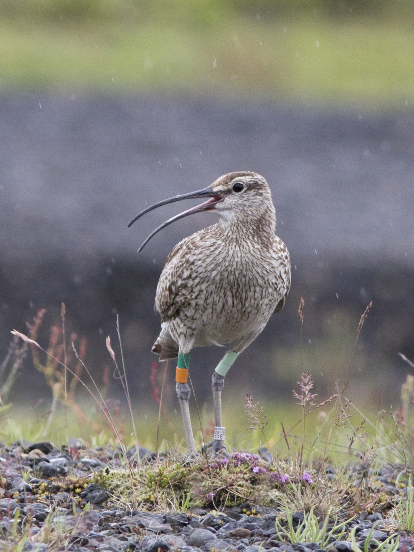
Global Whimbrel
Whimbrels are an iconic species found worldwide, with several subspecies/populations facing dire situations but others apparently doing well. Studies of single populations have allowed us to understand the distribution, migration routes and behaviour of Whimbrels, but by examining the global picture across subspecies and populations in a comparative framework we hope to gain deeper insights and uncover new routes for research.
Through a collaborative effort, we aim to create a global overview of Whimbrel migration by:
1. Mapping all tracking data and overlaying it on current distribution maps to identify knowledge gaps, e.g. areas where no or very few individuals have been tracked.
2. Comparing migration metrics, associated morphometrics, trends and threats between subspecies/populations.
3. Produce a list of relevant questions for future research based on the patterns detected in the previous aims.
Preliminary results
This collaboration has allowed to amass a dataset encompassing all subspecies across most flyways, totalling over 1.4 million locations from 229 individuals. We now start to have a good picture of whimbrel tracking across the globe and geographical gaps in it – a clear one being the breeding area in central Russian tundra, and non-breeding areas in East and Southern Africa and the Indian subcontinent. Such knowledge gaps can impair our understanding of the migration ecology of populations using this part of the world and therefore an accurate assessment of their conservation status. By inspecting the map, it is easy to see how subspecies vary in the length of their migration paths. Furthermore, variation in migration timings among subspecies is noticeable and deserves further reflection on its causes and consequences. Please explore the figures below and if you have questions about this project, don't hesitate to reach out.
Migratory routes with the breeding (triangles pointing downwards), wintering (triangles pointing upwards) and stopover sites (spring: circles; autumn: diamonds). Stopover symbol sizes represent duration. Each subspecies is show in a distinct colour.
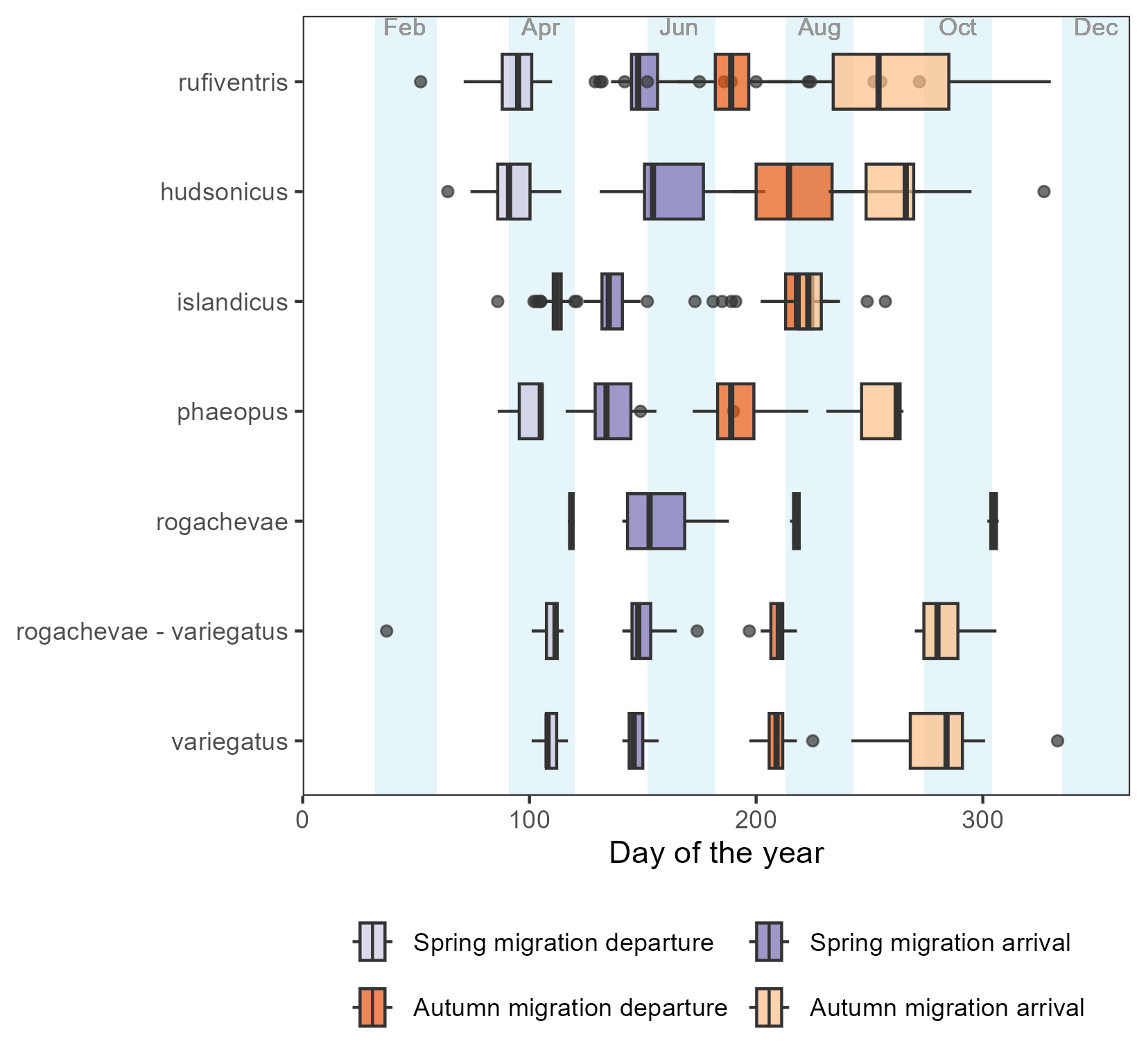
Timings of main migratory events across subspecies. Boxplots are slightly transparent to help detect overlaps. Months are marked by white and pale blue bars.
Contact us at globalwader@waderstudygroup.org
header and photo by Triin Kaasiku